
PLDYNA
free software for pipeline installation
an innovative engineering tool for the enterprise
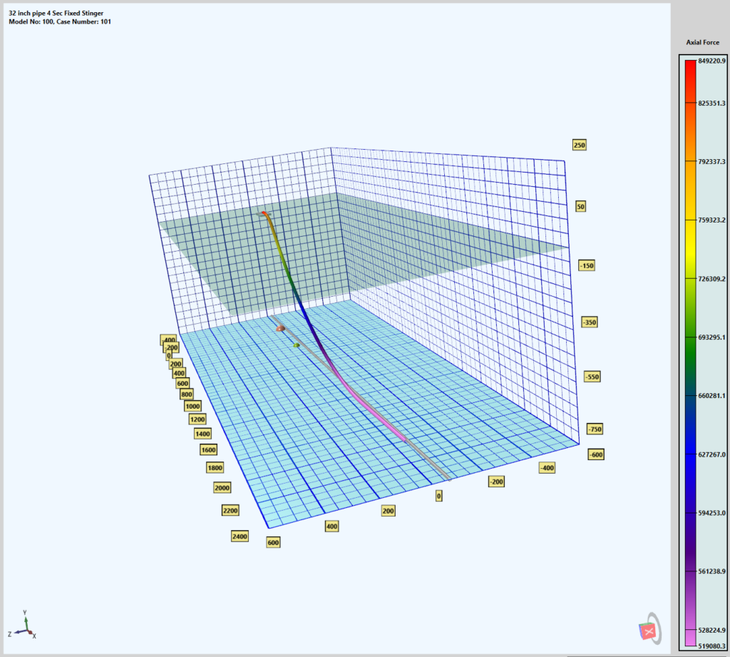
S-Lay with Fixed or Articulated Stinger
Pipelaying under currents and waves in 750 m water depth. PLDYNA calculates the required barge offset and alignment from the pipeline route to ensure that touchdown point remains on the pipeline route and the pipe tangent is oriented along the route.
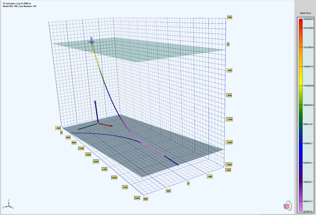
J-Lay to a Curved Route on a Sloped Seabed
32 inch pipe being laid to a curved proprietary profile route under currents and waves in 2000 m water depth on a 5 degree sloped sebed. Slope heading 20 degree from pipeline route. PLDYNA calculates the position and alignment of the barge to ensure touchdown actually follows the design route.
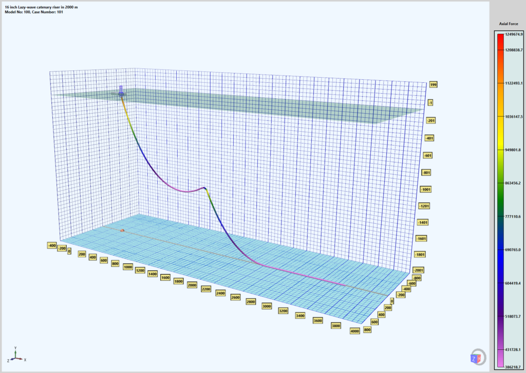
Hybrid Catenary Riser
16 inch Lazy-wave catenary riser in 2000 m water depth under currents and waves.
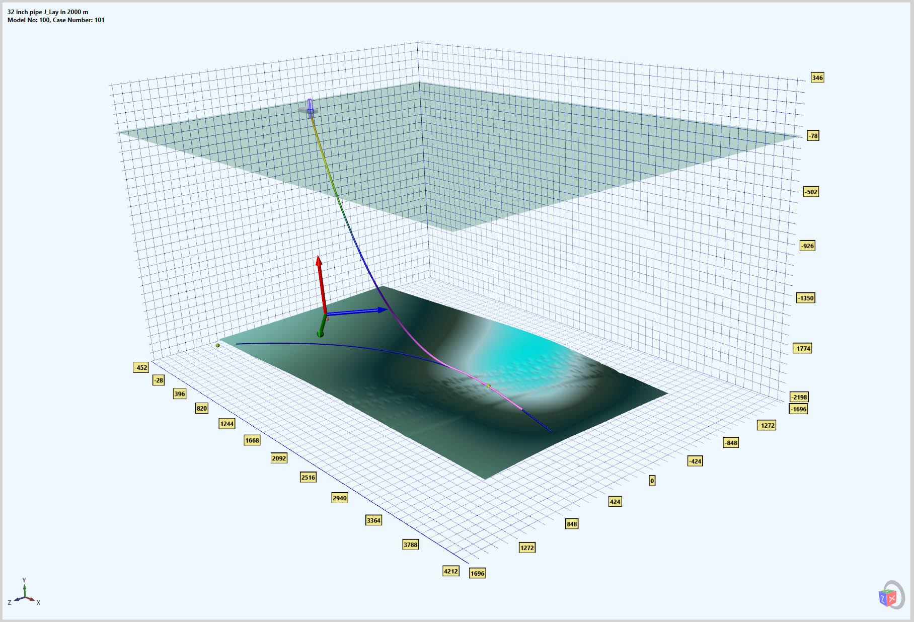
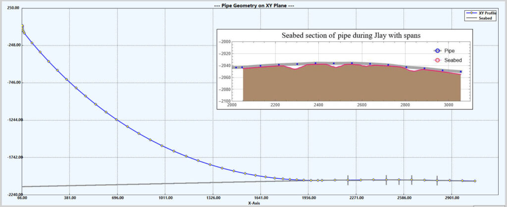
Example shows J-Lay analysis during laying to a Curved Route on a given terrain featuring furrows and other obstacles. It contains static and dynamic analysis of the pipeline from the tensioner to a steady state boundary on the seabed including all the unsupported spans.
PLDYNA can read most ASCII based terrain data such as any XYZ and Arc GIS GRID (ASC) Files.
It identifies the spans and determines the forces and moments generated by the spans using the actual axial forces experienced by the pipe.
NOW YOU CAN DO SPAN AND LAY ANALYSIS AT THE SAME TIME.
IMPORTANT PLDYNA FEATURES

PLDYNA auto generates a robust and realistic model of the pipelaying system without any need of user defining elements, rollers, buoys, tensioner, stinger, and J-Tube (under development). This is accomplished using actual engineering specifications of the equipment.
PLDYNA calculates roller elevations for various of types of rollers to maintain the desired pipe profile both on the barge and along the stinger. This is not a trivial task. No more chaotic or irregular roller reactions due to errors in roller elevations.
PLDYNA creates a tensioner model following the design of most modern tensioners. Tensioner specifications are important for dynamics.
PLDYNA creates a dynamically and hydrodynamically accurate model of stinger. This is important for the dynamics of articulated stingers.
PLDYNA provides attachment of various shapes of spar buoys in different orientation to the pipe. Buoyancy forces are calculated using actual position of buoys, wetting volume, and wave surface as pipeline moves during dynamic analysis.
PLDYNA conducts both static and explicit dynamic analysis. The explicit dynamics output can be directly compared with the values measured or observed during pipelaying.
PLDYNA is an extremely efficient and accurate based on a rigorous theory.

In order to facilitate reuse of models, PLDYNA is based on an object oriented hierarchical graph representing all components of pipelaying system. All PLDYNA input and output is saved in a relational database reflecting this graph. The Data Bases can be saved in the form of user accessible files.
Standard equipment Data Bases can be shared across enterprise boundaries. This not only improves efficiency, but also ensures accuracy of the equipment specifications used. It can also help maintain continuity between the design office and the pipelay barge.
A complete PLDYNA model can be built in minutes connecting various existing Data Bases containing standard pipe data, stinger sections, roller types, tensioners, spar buoys, physical environment, and seabed properties.
PLDYNA incorporates algorithms to support commonly used pipelaying procedures such as A&R, aligning barge to maintain the touchdown point on the pipeline route under currents and waves and same for laying to a curved route.
PLDYNA Scripting Language allows querying its database and programming common analysis processes and post processing of output.
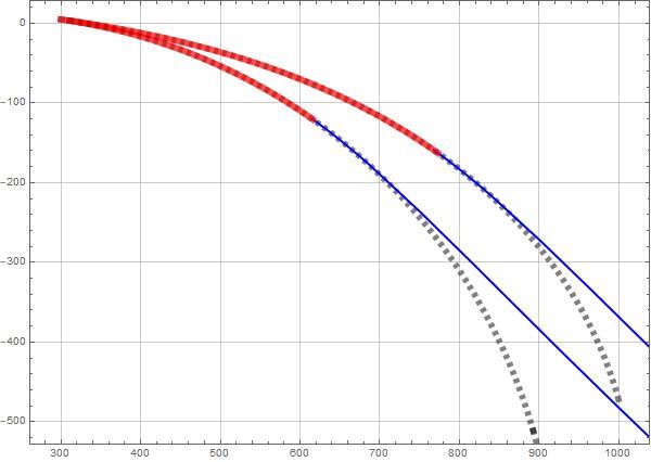
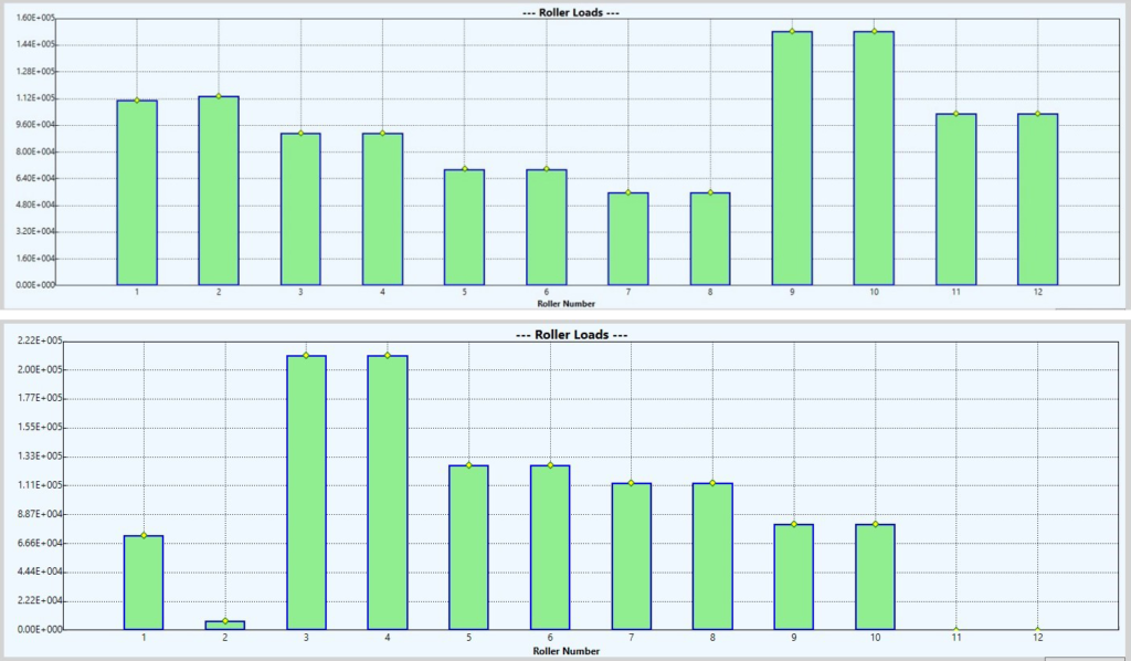
PLDYNA offers an alternative overband profile to circle based on a mathematical curve (Euler). The curvature of the pipe profile based on this curve can start at zero on the barge. In the case of circular profile, because pipe curvature cannot change from zero to a finite value, pipe typically does not follow the circle profile. This results with irregular and higher roller loads. The PLDYNA output shown on the right presents the roller load distributions for Euler and Circle profiles respectively. The figure on the left demonstrates a second benefit of Euler profile. By adjusting tension, bending moment at departure can be reduced with Euler profile as curvature gradually decreases towards the barge. In the case of circle profile, The curvature remains constant regardless of departure location.

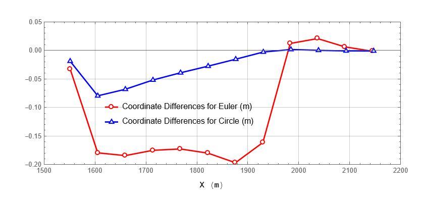
When pipeline route changes from straight line to circular route, bending moment is expected to change from zero to a finite and constant value. This is typically only feasible if an external restraint is applied. Seabed soil lateral resistance is not sufficient to provide sufficient restraint. Therefore, as soon as the barge moves to follow circular pipeline route, pipe readjusts laterally to maintain continuity of bending moment.
Similar to stinger Euler profile, PLDYNA provides an option to design a route profile which maintains bending moment distribution across straight and curved sections of the pipeline route. Figure below shows the pipeline movements from the design route as pipeline equilibrates internal and soil resistance forces.
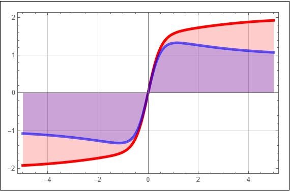
PLDYNA provides a general seabed lateral load model incorporating initial breakout and later berm building forces. Vertical Forces and displacements are calculated using a quadratic Winkler foundation. Figure on the left illustrate monotonic and asymptotic load functions generated using PLDYNA seabed model.

PLDYNA uses a modern and accurate travelling wave theory by John D. Fenton. A 20 term Fourier approximation is constructed for dynamic analysis. This theory incorporates inline currents. The theory and various applications are described in the following link.

PLDYNA comes with graphical applications for S-Lay and J-Lay analysis. These graphical front ends can be used to control PLDYNA analysis module and to query its data base. It also provides facilities to plot both static and dynamic analysis results.
Dynamic analysis results are presented as a surface in 3D. Plan view provides the geometry and depth is used to represent variation in time. Color textures present displacements, bending moment, or axial forces at a point on the pipe, at a given time. It was determined that this way of presentation is far more useful and meaningful for engineers versus animation of results.
PROJECTS
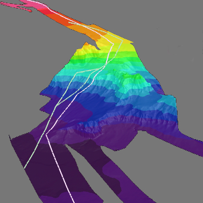
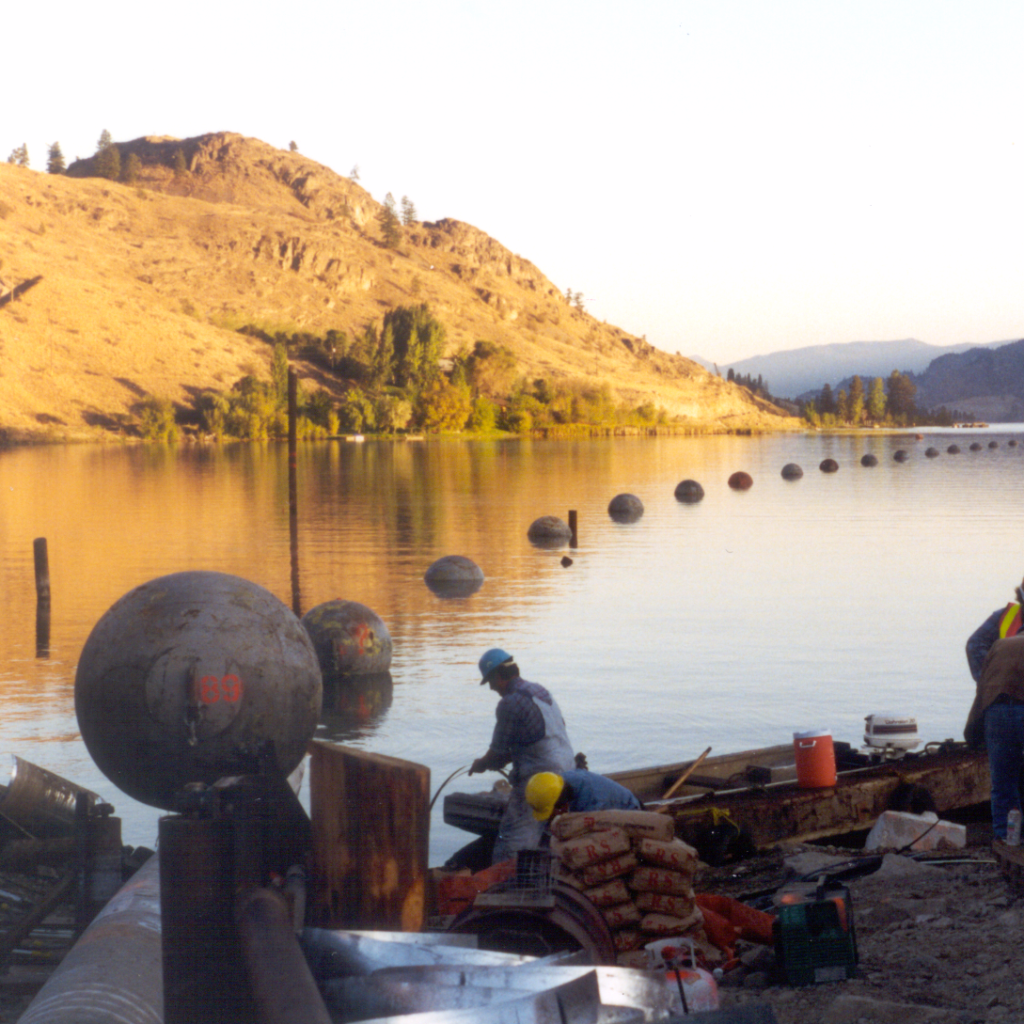
PLDYNA has been used in novel and challenging projects including MEDGAZ and Skaha Lake Gas pipeline. PLDYNA unique features proved critical in these projects.
DOWNLOAD DOCUMENTATION AND PROGRAM FILES
The following ZIP file contains REFERENCE, GRAPHICAL INTERFACE, and EXAMPLES documents in PDF format.